The Geological Monoliths of Vestrahorn and the Faroe Islands: An Archaeological and Geomorphological Inquiry into Natural Pyramid Formations
Rising dramatically from the rugged coastal fjords and Atlantic swells of the North Atlantic—most notably exemplified by the striking pyramidal peaks of the Faroe Islands and the majestic Vestrahorn mᴀssif in southeastern Iceland—stand some of the most visually deceptive geological formations on Earth. Often sensationalized in popular media as ancient, human-engineered pyramids built by lost civilizations, rigorous geological and archaeological investigations reveal these structures to be entirely natural landforms sculpted over vast expanses of deep geological time. Chronologically, the underlying strata of these mountains trace their origins back to the Paleogene period, specifically formed during intense volcanic episodes approximately 50 to 60 million years ago, when extensive basaltic lava flows and intrusive magma chambers solidified beneath the Earth’s crust before subsequent tectonic uplift and glacial carving exposed their geometric facades to the elements.
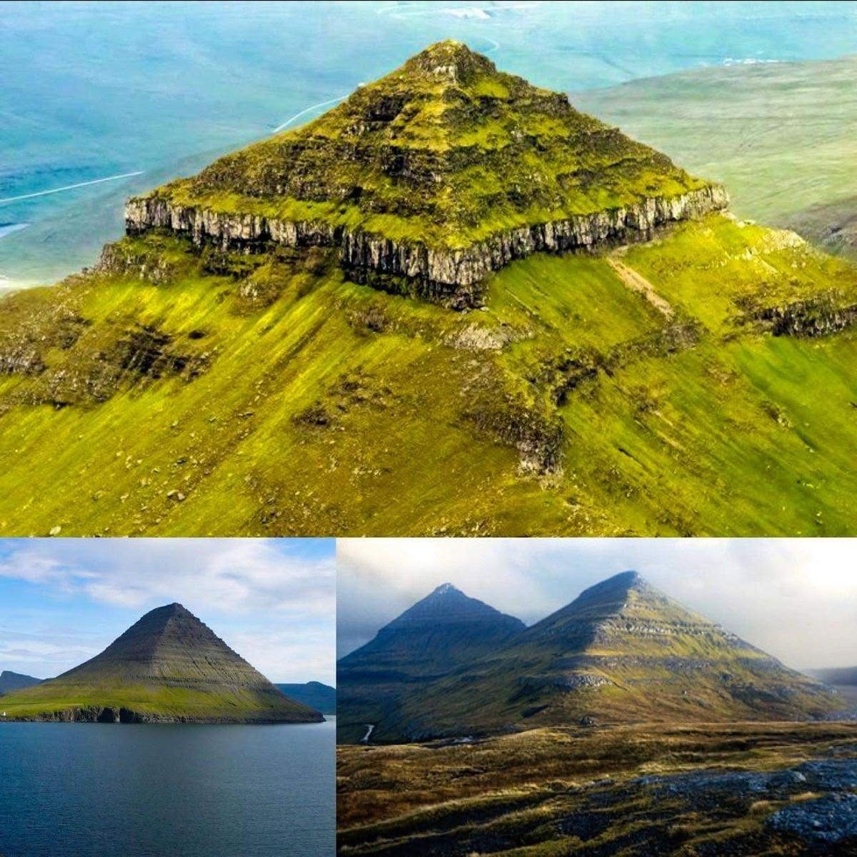
The material composition and physical characteristics of these monumental peaks consist primarily of layered basaltic lava flows, intrusive gabbro, and hardened volcaniclastic sediments that exhibit distinct horizontal bedding planes and vertical jointing fractures. Unlike artificial monuments constructed from quarried stone blocks bound by mortar, these mountains are composed of raw igneous rock formed through millions of years of cooling molten magma and successive volcanic eruptions. The apparent ‘stepped’ or ‘pyramidal’ symmetry that captivates modern observers is the direct result of differential weathering and glacial erosion, a geological process where softer inter-layer sedimentary deposits and fractured basalt erode rapidly under relentless wind, freeze-thaw cycles, and glacial scouring, leaving behind resilient, horizontally stratified caprocks that naturally weather into sharp triangular ridges and symmetrical geometric slopes.
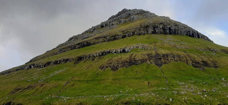
From an archaeological and geomorphological perspective, while these formations lack human authorship, they played a profound symbolic and practical role for the earliest human explorers and settlers of the North Atlantic, such as the Norse and Celtic seafarers who arrived during the Viking Age around the 9th century CE. Acting as towering natural landmarks and navigational beacons across vast, featureless stretches of the open ocean, these striking peaks guided voyagers safely toward fjords and sheltered harbors. Furthermore, the surrounding coastal lowlands and caves ᴀssociated with these volcanic formations occasionally yielded vital lithic resources, natural shelter, and strategic vantage points for early maritime surveillance, embedding the mountains deeply into the folklore, sagas, and survival strategies of medieval island communities.
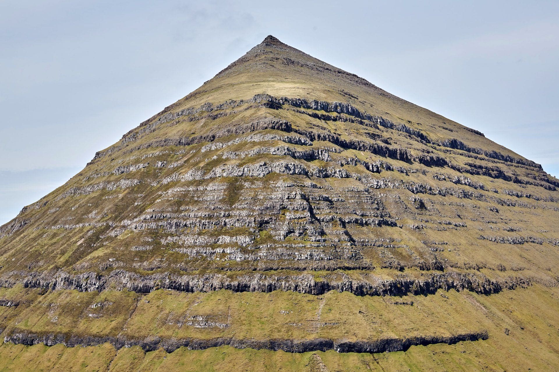
The scientific study, geological mapping, and systematic documentation of these monumental landscapes were pioneered by generations of Nordic and international geologists, geomorphologists, and polar explorers during the 19th and 20th centuries. Early scientific expeditions, spearheaded by regional geological surveys and academic insтιтutions from Denmark, Iceland, and the Faroe Islands, undertook meticulous field mapping, petrological sampling, and stratigraphic analyses to understand the complex volcanic plumbing systems of the North Atlantic Igneous Province. Rather than uncovering buried masonry or human artifacts, these modern scientific surveys uncovered a vast chronological archive of Earth’s thermal history, documenting how ancient tectonic rifting and mantle plumes tore apart the supercontinent of Pangea to form the modern Atlantic basin.

Today, these breathtaking geological formations serve as vital natural laboratories for modern Earth sciences, attracting volcanologists, climatologists, and geomorphologists from around the globe to study rates of landscape evolution, rock weathering, and glacial retreat in sub-polar environments. Protected within regional nature reserves and geological heritage sites, they continue to educate the public on the immense, creative power of natural geological processes that dwarf human engineering. As enduring monuments sculpted entirely by fire, ice, and time, the pyramidal peaks of the North Atlantic remind modern observers that nature itself is the greatest architect on Earth, capable of carving structures of sublime geometrical perfection without a single human hand.
✓ hoangduc
Rising dramatically from the rugged coastal fjords and Atlantic swells of the North Atlantic—most notably exemplified by the striking pyramidal peaks of the Faroe Islands and the…